These complete solutions include manufacturing, installation and service of weather and hydrological stations, complete data management including quality control and providing of SW solutions for creating of hydrological outputs – forecasts of water level, discharge, flood warning information and construction of maps of flood. Company provides consultations, problem analyses and support of hydrological systems too.
HYDROLOGICAL MODELING AND FORECASTING
Hydrological modeling is an effective tool for simulation of hydrological processes with the fruitful outputs in many fields. Our system is modular-based and enables the user to use one, or multiple platforms to perform the required outputs. MicroStep-MIS fulfils the above mentioned goals by implementing various modeling tools.
- Complex rainfall – runoff models
- Models of parts of runoff generation process including specific snow-accumulation – snow melt / runoff models
- Hydrodynamic (1 - 2D) models
- Flash – flood modeling tools
Simulations are provided in the form of studies, or in the form of the forecasting and warning system working in the real-time and providing hydrological forecasts to responsible institutions, decision makers and public. Forecasting and warning system uses the real-time measured and forecasted values of precipitation and temperature. Analyses of snow cover and snow-melt processes are included in our systems too.

- HYDROLOGICAL FORECASTIGN AND WARNING
- LAND PLANNING AND DEVELOPMENT
- COUNTRY MANAGEMENT
- RESEARCH AND STUDIES
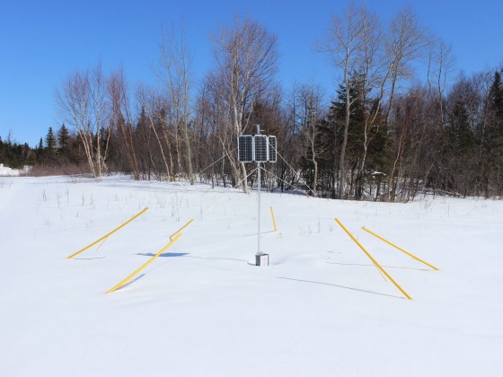
Hydrological Monitoring

Hydrological portal HYPOS
The environmental database is the main engine providing the data for the flood warning system. The database integrates data and performs regular data quality checks.

Hydrological Forecasting
The complex network of models is used for the water level and discharge forecast. The variety of models is ranging from simple empirical formulas to rainfall-runoff models with ensemble data sets. The advanced system for models configuration and management is part of the hydrological portal HYPOS. The data visualization and processing is also fully integrated into the portal. Special part of the system is flash flood warning system based on the flash flood guidance method.
The environmental database is the main engine providing the data for the flood warning system. The database integrates data and performs regular data quality checks. The database integrates these data types:
- Hydrological data from water level stations
- Measured hydrological data
- Hydrological forecasts
- Metadata of the meteorological stations
- Measured meteorological data
- Data from the meteorological satellites and radars
- Data from the meteorological models
- Geographic data
- Configurations
The complex network of models is used for the water level and discharge forecast. The variety of models is ranging from simple empirical formulas to rainfall-runoff models with ensemble data sets. The advanced system for models configuration and management is part of the hydrological portal HYPOS. The data visualization and processing is also fully integrated into hydrological portal. Special part of the system is flash flood warning system based on the flash flood guidance method.