Meteorology & Climatology

Radiowave Communications Limited operates worldwide and specializes in distribution of monitoring and information systems, processing of acquired data, research and numerical modeling.

  • Automatic Weather Stations and Manned Weather Stations
  • Data collection systems
  • Climatological and operational database systems
  • Numerical weather modeling and forecasting
  • Calibration and adjustment of the meteorological sensors

AUTOMATIC WEATHER STATION

IMS4 CLDB AND ENVIDB | INTEGRATED ENVIRONMENTAL DATABASE

Climatological database is a critical component of any modern meteorological institute of today. The main utilization of such system is storage of all collected meteorological data in one unified structure to avoid data inconsistencies and discrepancies and to enable standard comfortable data access for all users and other software systems.

Within the Climatological Database (CLDB), the above mentioned unified structure is based on SQL Database Server and the standard data access is based on SQL language. The guarantee of data storage quality is the industry proven Oracle® Database Server, the world leader in database technologies. Great alternative for smaller systems is based on an open source solution offered by PosgreSQL. CLDB is based on WMO1 recommended practices for climatological data processing (WMO Guide No. 100). It follows the WMO suggestion of a RDBMS (Relational Database Management System) application with wide use in climatology (World Climate Program efforts concerning new Climate Data Management Systems - CDMSs).
Great advantage of CLDB is its modular architecture, which gives the end user the possibility of detailed customization. The end user can specify additional non-standard input and output modules. Modules can be easily implemented and added to any existing or future installation. One of the most interesting extensions offered is upgrade to environmental database (integration of AWS, radar, satellite, profiler, historical observations, marine data, radiation and air pollution monitoring and more). To provide high availability of the database we use Oracle Real Application Cluster - the database solution provides fault tolerance and high performance for mission-critical applications.
Image
  • SCALABLE SOLUTION & METADATA MANAGEMENT
  • HIGH AVAILABILITY OPTION & EXPORT TO STANDARD FORMATS
  • MANUAL  / AUTOMATIC DATA SOURCES & MATHEMATICAL / STATISTICAL PACKAGES
  • HIGHLY CONFIGURABLE QUALITY CONTROL
  • ADVANCED GRAPHICAL PRESENTATION TOOL AND MAP ANALYSIS
Image

IMS4 MAPS

IMS4 Maps is a tool for processing, editing and sharing on the web of the geospatial data, both static data sets (topography) as well as current, historical or forecast, surface or upper air meteorological, climatological, hydrological, radiation and/or other environmental ones.

The IMS4 Maps web client provides users with an easy to use interface to access, browse and animate various data layers
Image

IMS4 MODEL SUITE

The IMS4 Model Suite provides a composition of modern models and simulation technologies for meteorology, hydrology, radiation and air quality.

Models run both operatively and in research mode. IMS4 Model Suite is an integrated, easy-to-use, powerful system for modeling, processing, visualisation and model validation. IMS4 Model Suite is a complex system for supporting forecasters as well as crisis managers. Its application ranges from regular daily forecasting purposes to decision support in emergency.
  • RADIATION AND POLLUTANT CRISIS MODELLING
  • ROAD CONDITION MODELING
  • HIGH RESOLUTION, SHORT TERM WEATHER FORECASTING AND NOWCASTING
  • VISIBILITY MODELING
  • SAND STORM MODELING
  • HYDROLOGICAL MODELING
Image

IMS4 WEATHER STUDIO

IMS4 Weather Studio is a unique tool for processing, analyzing and graphic presentation of the surface and upper air meteorological, radiation and climatological data.

The easy-to-use tool provides convenient way for objective analysis and displaying of complex data - real-time data distribution systems (GTS), SADIS, as well as data outputs from Numeric Weather Prediction models (NWPs).

IMS4 Weather Studio has an inestimable wide use in meteorological institutions, forecasting services, and crisis centers, airports, at climatological research and dispersion modeling and for many other users.

  • METEOROLOGICAL AND PILOT BRIEFING
  • STANDALONE APPLICATION OR INTEGRATED WITH IMS4 MESSAGE SWITCHING AND DATA PROCESSING SERVER
  • SUPPORTS STANDARD METEOROLOGICAL FORMATS
  • ARCHIVE OF VARIOUS SETTINGS SAVED BY INDIVIDUAL USERS

MMR-116 | MINI METEOROLOGICAL RADAR

Mini Meteorological Radar MMR-116 is a unique portable X-band weather radar with large functionality integrated into the small device sold for favorable price. The radar provides real time insight to weather situation and is capable to detect precipitation 10 dBZ at distance 200 km.

MMR-116 answers the increasing demand for water management tools and hazardous meteorological phenomena detection. Watershed management, global warming adaptation strategies, flood protection, operational weather forecast, military and civil defense actions or aviation safety are supported by this radar. The combination of its size and low price implies wide use in the water management, tourism, media, transport, military, civil defense, aviation and agriculture.

MMR-116 is exceptionally powerful radar approaching the performance of the big radars. Its capabilities allow the design of efficient small radar networks which have important advantages compared to the single radar with long range. MMR-116 comes with the Radar Software displaying meteorological spatial data in user-friendly graphic form.
Great advantage of CLDB is its modular architecture, which gives the end user the possibility of detailed customization. The end user can specify additional non-standard input and output modules. Modules can be easily implemented and added to any existing or future installation. One of the most interesting extensions offered is upgrade to environmental database (integration of AWS, radar, satellite, profiler, historical observations, marine data, radiation and air pollution monitoring and more). To provide high availability of the database we use Oracle Real Application Cluster - the database solution provides fault tolerance and high performance for mission-critical applications.
Image
  • LARGE AMOUNT OF FUNCTIONALITY INTEGRATED INTO SMALL DEVICE
  • REAL TIME INSIGHT TO WEATHER SITUATION
  • FULLY AUTOMATIC OPERATION WITHOUT SERVICING STAFF
  • LOW WEIGHT AND SMALL DIMENSIONS
  • USER-FRIENDLY GRAPHIC INTERFACE ACCORDING TO CUSTOMER´S REQUIREMENTS

MANNED WEATHER STATION

IMS4 Observer Workstation is the version of Integrated Meteorological System application software designed to interface the automatic weather station MicroStep-MIS AMS 111 model or a 3rd party data logger.

It performs continuous measurement and/or data collection from the connected automatic weather station, data processing (quality control, recalculations), and archiving. IMS4 provides the user with the real-time screen displaying the current data, as well as modules for data export into Microsoft Excel / OpenOffice. Org Calc, and for displaying the data time series in the form of charts.

Great advantage of CLDB is its modular architecture, which gives the end user the possibility of detailed customization. The end user can specify additional non-standard input and output modules. Modules can be easily implemented and added to any existing or future installation. One of the most interesting extensions offered is upgrade to environmental database (integration of AWS, radar, satellite, profiler, historical observations, marine data, radiation and air pollution monitoring and more). To provide high availability of the database we use Oracle Real Application Cluster - the database solution provides fault tolerance and high performance for mission-critical applications.
Image
  • INTERFACES TO THE VARIOUS SENSORS AND DATA LOGGERS
  • QUALITY CONTROL, VERIFICATION OF MEASURED DATA
  • REAL-TIME WEATHER DATA DISPLAY
  • VISUALIZATION OF MEASURED DATA
Image

MICROCLIMATE CAVE MONITORING SYSTEM

Microclimate Cave Monitoring System aim is a detail measurement, recording and storing of data of selected natural parameters of cave environment.

Cave Monitoring System is a unique integrated system consisting of permanent and mobile data loggers, communication network, data collection and central database and management system.

The core of monitoring system are installed loggers where the measured data are ingested. All loggers in the cave are connected to the common communication bus. The outside logger with the GSM signal coverage is used for all collected data transmission. Mobile monitoring systems are portable stations with loggers and sensors. They are intended for short time measurements or for measurements on site without wiring. These stations works as autonomous systems with a local data storage on batteries.

The central system automatically collects data from all loggers and database provides quality control and easy access to measured data.
  • COMPACT DESIGN
  • DATA LOGGER REMOTE CONFIGURATION, MONITORING AND SOFTWARE UPDATE
  • BATTERY EQUIPPED DATA LOGGERS AS THE ENSURANCE OF CONTINUOUS OPERATION
  • EASY DATA ACCESS THROUGH THE WEB INTERFACE
  • EASY MANIPULATION (INTERCHANGEABLE LOGGERS)
Image

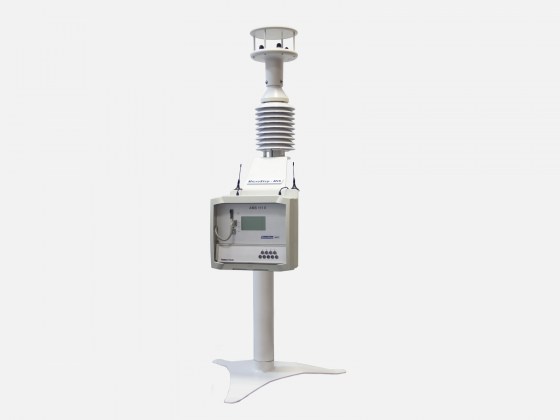
UDCS | UNIFIED DATA COLLECTION SYSTEM

Meteorological, hydrological, radiological and other environmental data can be useful only after they reach the end users.

Information and communication technologies have never been more important in the world of hydrological monitoring. IMS4 UDCS is a data collection and switching system built on the field proven IMS4 platform for meteorological, hydrological, radiation and environmental data acquisition and remote system maintenance.

  • SCALABILITY
  • FAULT TOLERANCE
  • HIGH AVAILABILITY
  • SUPPORTS WIDE CHOICE OF PROTOCOL

GET IN TOUCH

With our professional team and quality tools & equipment, we have the capacity to design, develop, install and commission reliable, effective and efficient Weather Monitoring solutions on any scale. Get in touch with us and let us know how we can help you achieve communication efficiency.


We are one of the leading providers of Wireless & Navigation, Voice and Data solutions with over 15 years of experience. We are also the official authorized Garmin Distributor in Tanzania providing innovative and exciting products.

Downloads

  •   (255) 772 775 775
  •   (255) 687 887 225
  •   (255) 784 531 153
  •   salescentre@radiowave.co.tz
  •   sales@radiowave.co.tz